- Surface Geology
- Physiography
- Vegetation
- Climate
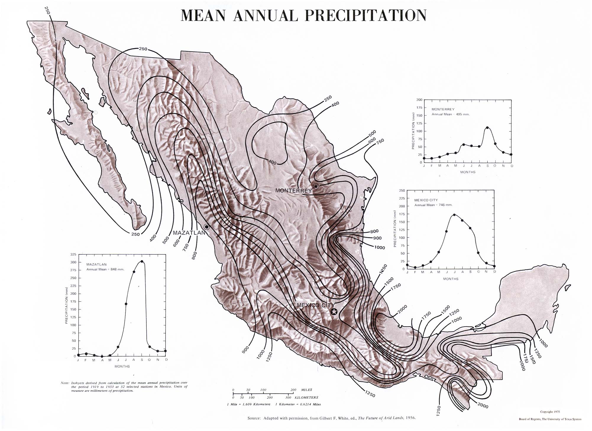
- Mean Annual Precipitation
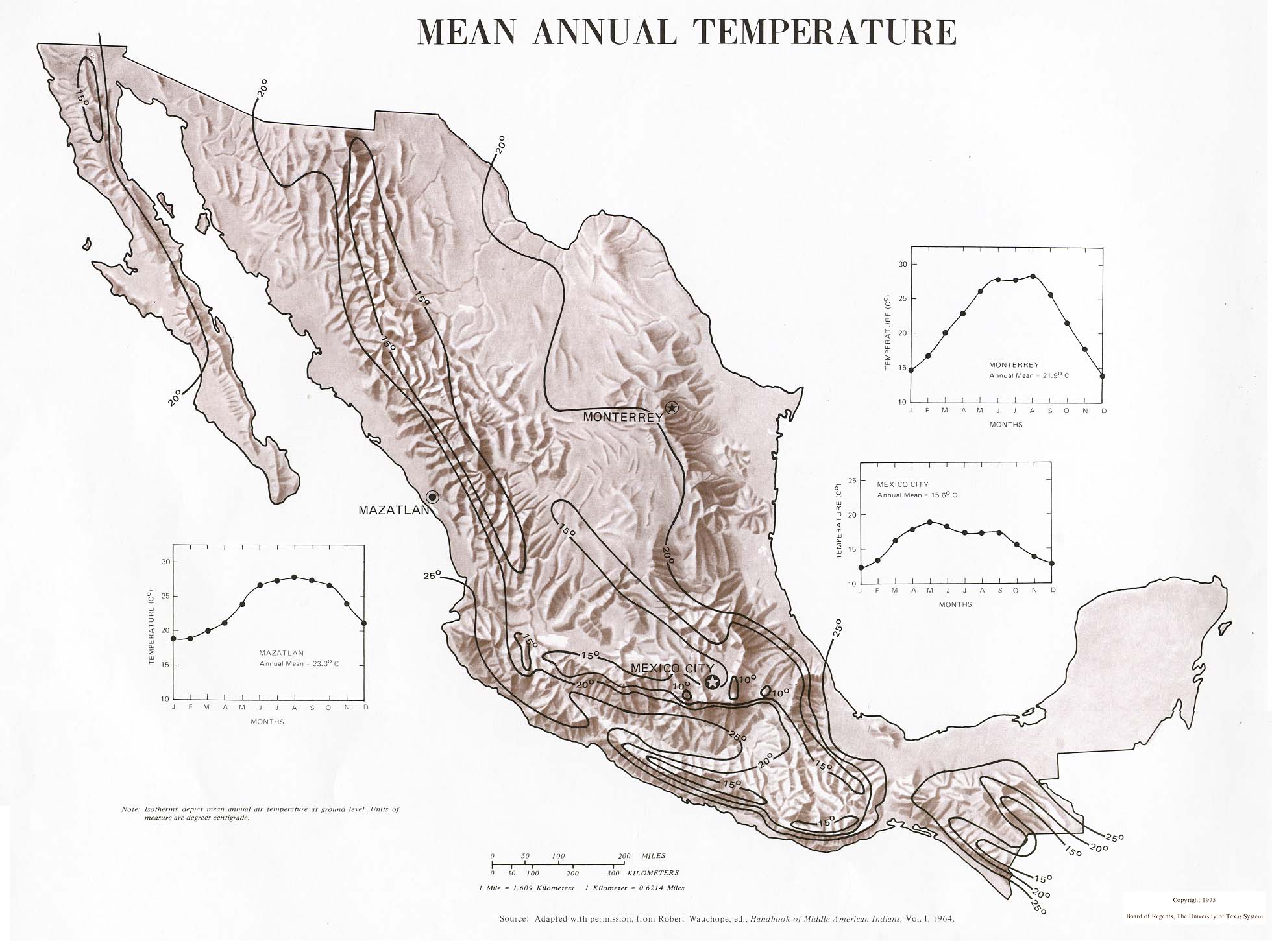
- Mean Annual Temperature
- Indigenous Languages
- Mining and Industries
- Population
- Highways
- Railroads
- Roads
- Mexico City
- Merida
- Mazatlan
- Mexico City Public Transit
- Merida Public Transit
- Mazatlan Public Transit
- Mexico City Tourist Recommendations
- Merida Tourist Recommendations
- Mazatlan Tourist Recommendations
Physical Environment
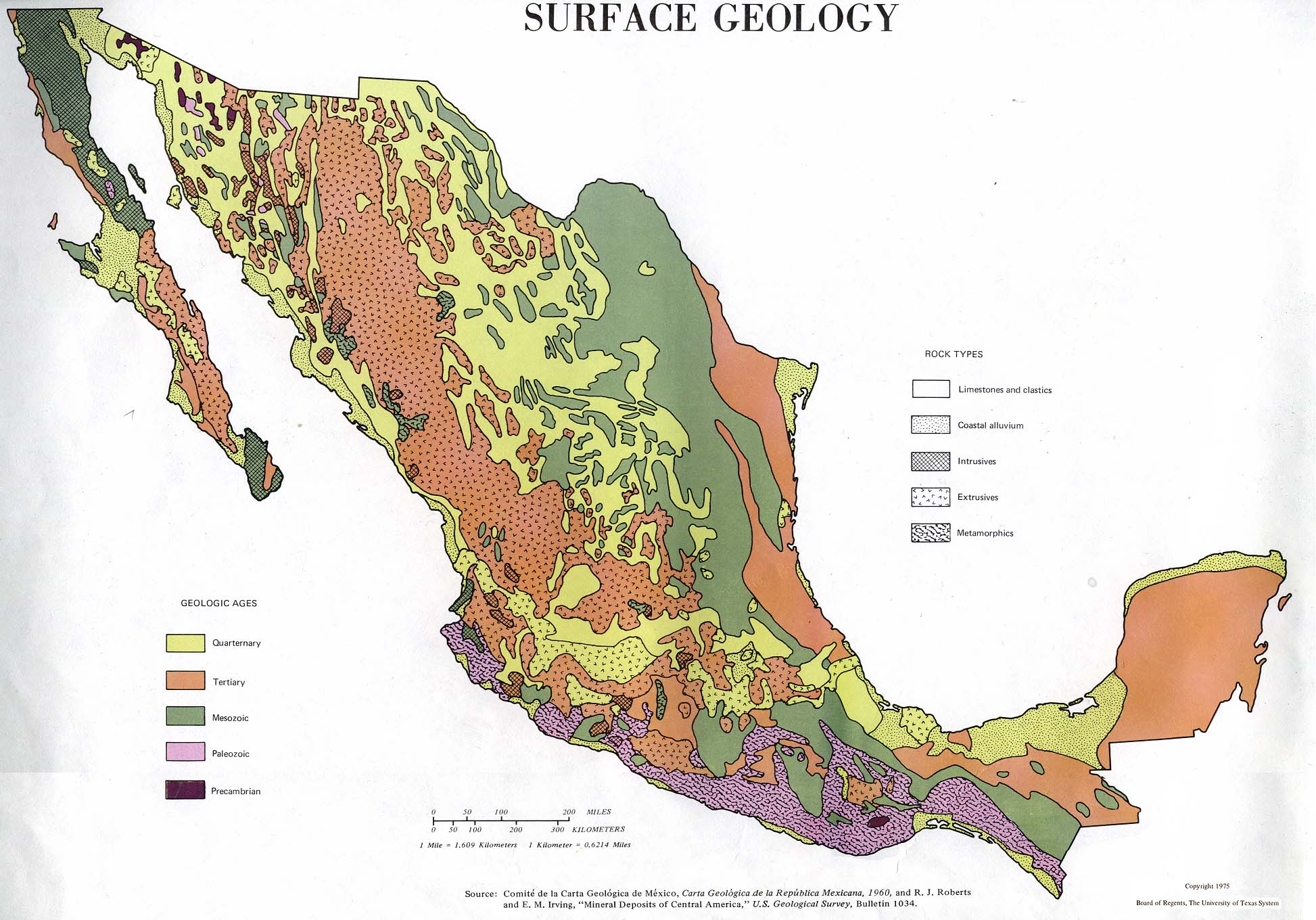
Figure 1.1 This map shows the surface geology of Mexico; soil types and sediments.
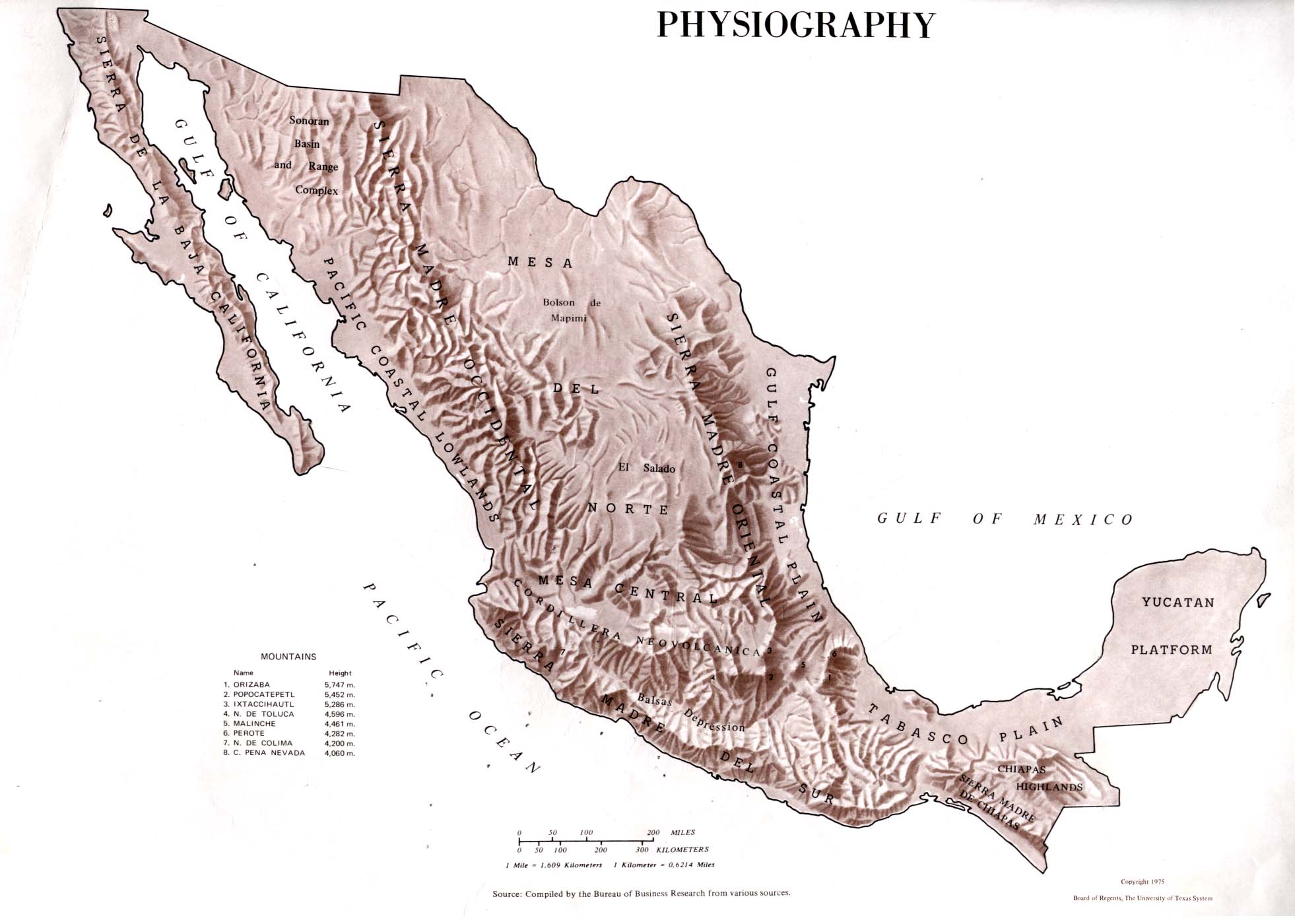
Figure 1.2 This map details the geological land forms; mountains, plains, lowlands, highlands, depressions, etc. This will help when planning my trip because I will know what types of gear to bring with me.

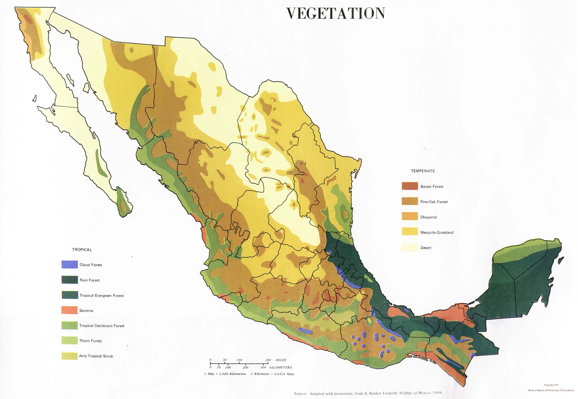
Figure 1.3 This map details the different types of vegetation. This map will tie into weather and climate, but lets me see what kind of environment I'm dealing with, whether it be desert or forest.
Weather & Climate

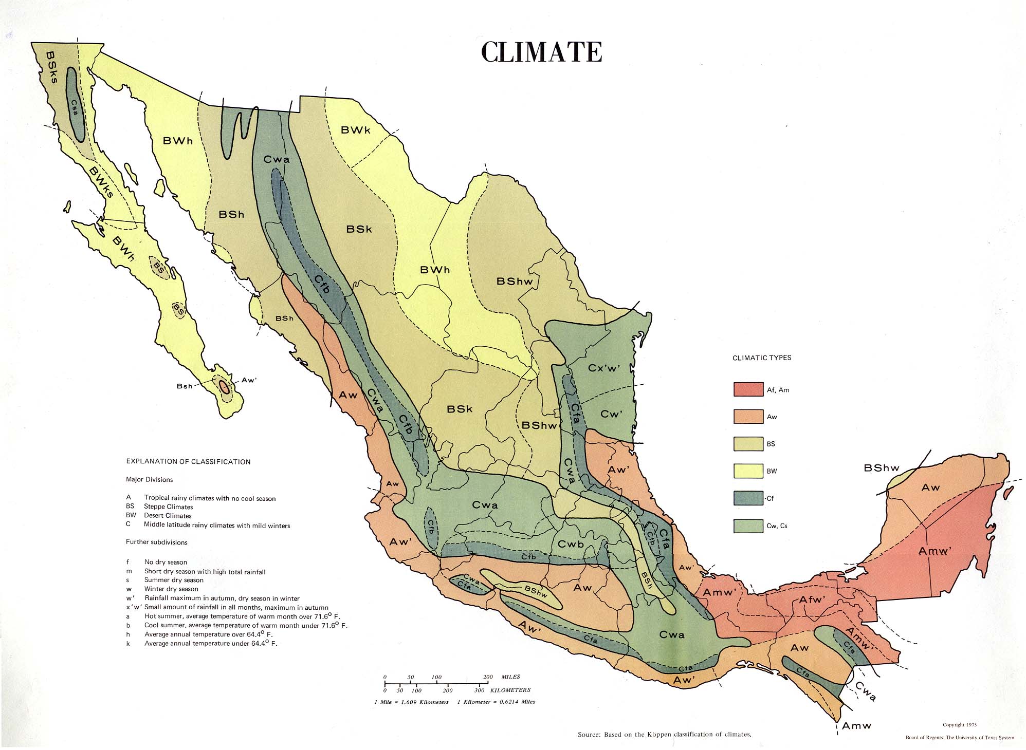
Figure 2.1 This map details the different Koppen Climate types throughout Mexico. This map is very important, as it always me to chose where specifically I would like to visit while also properly chosing what type of attire I would need to wear while on my trip.

Figure 2.2 This map shows annual precipitation throughout Mexico. Annual precipitation is important because it shows the months were precipitation is highest. I specifically chose this map because it shows two cities I have on my trip list: Mazatlan and Mexico City.

Figure 2.3 This map shows the annual temperature throughout Mexico. Temperature is important, especially when you're looking at the type of climate you're dealing with; humidity and high temperatures can be dangerous, just like low humidity and high temperatures can be. This map was also specifically chosen because it shows two cities on my list in detail: Mazatlan and Mexico City.
Human Environment
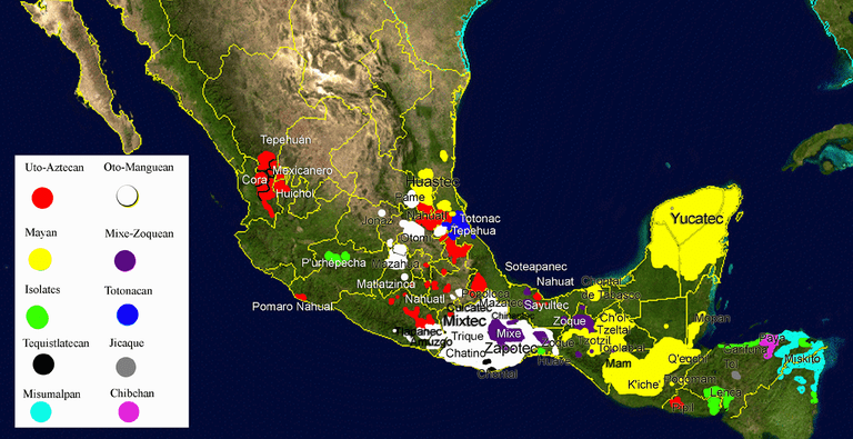
Figure 3.1 This map details the different indigenous languages spoken throughout Mexico. This map is important to my trip because I chose Mexico for it's historical and cultural aspects. I speak Spanish semi-fluently and I can use this map to research the history of the languages and possibly learn phrases to use on my trip with indigenous peoples.
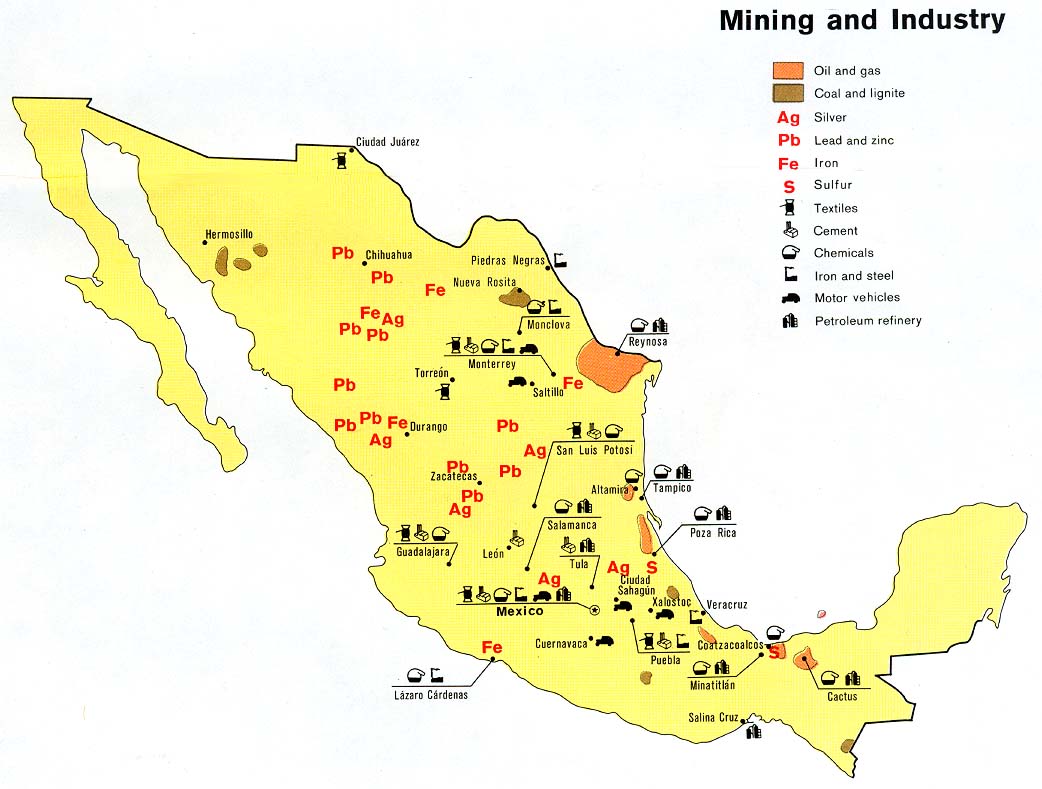
Figure 3.2 This map shows us the different types of minerals being mined and industrial sites in Mexico. This choice may seem odd, but I actually chose this map because it showed textiles; I would likely be purchasing certain textiles while on my trip.
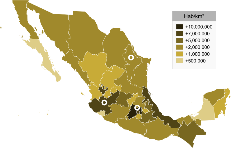
Figure 3.3 This map shows the approximate population density of each Mexican province. This is important because it will allow me to properly prepare a place to stay; a more densly populated area may have more options to make a home base while abroad but the availability may vary depending on the time chosen.
Road Maps
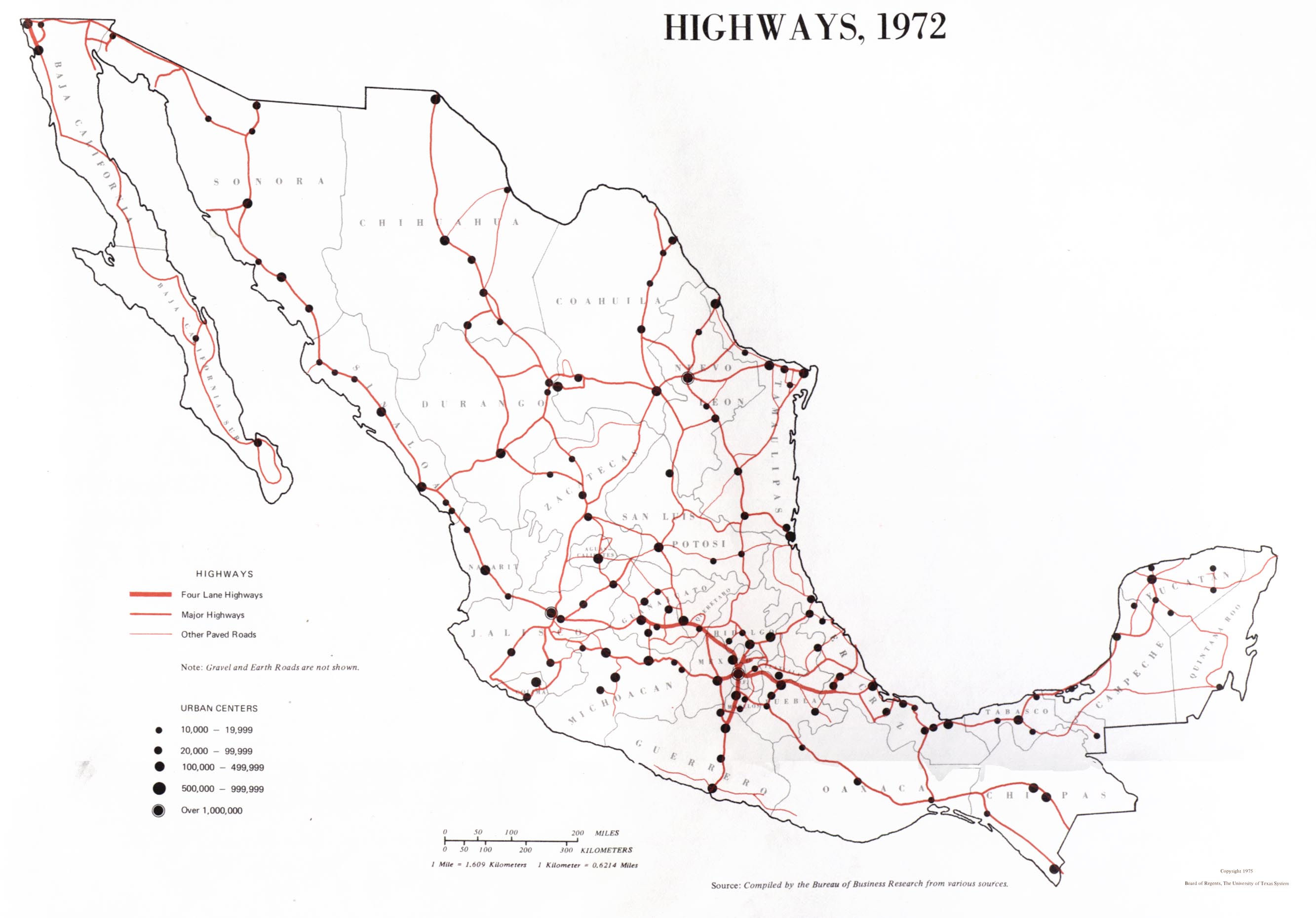
Figure 4.1 This map shows the different highways across Mexico. I chose this highway map because it shows the major highway systems branching out from Mexico City; this is important because Mexico City is my point of interest when flying into the country.
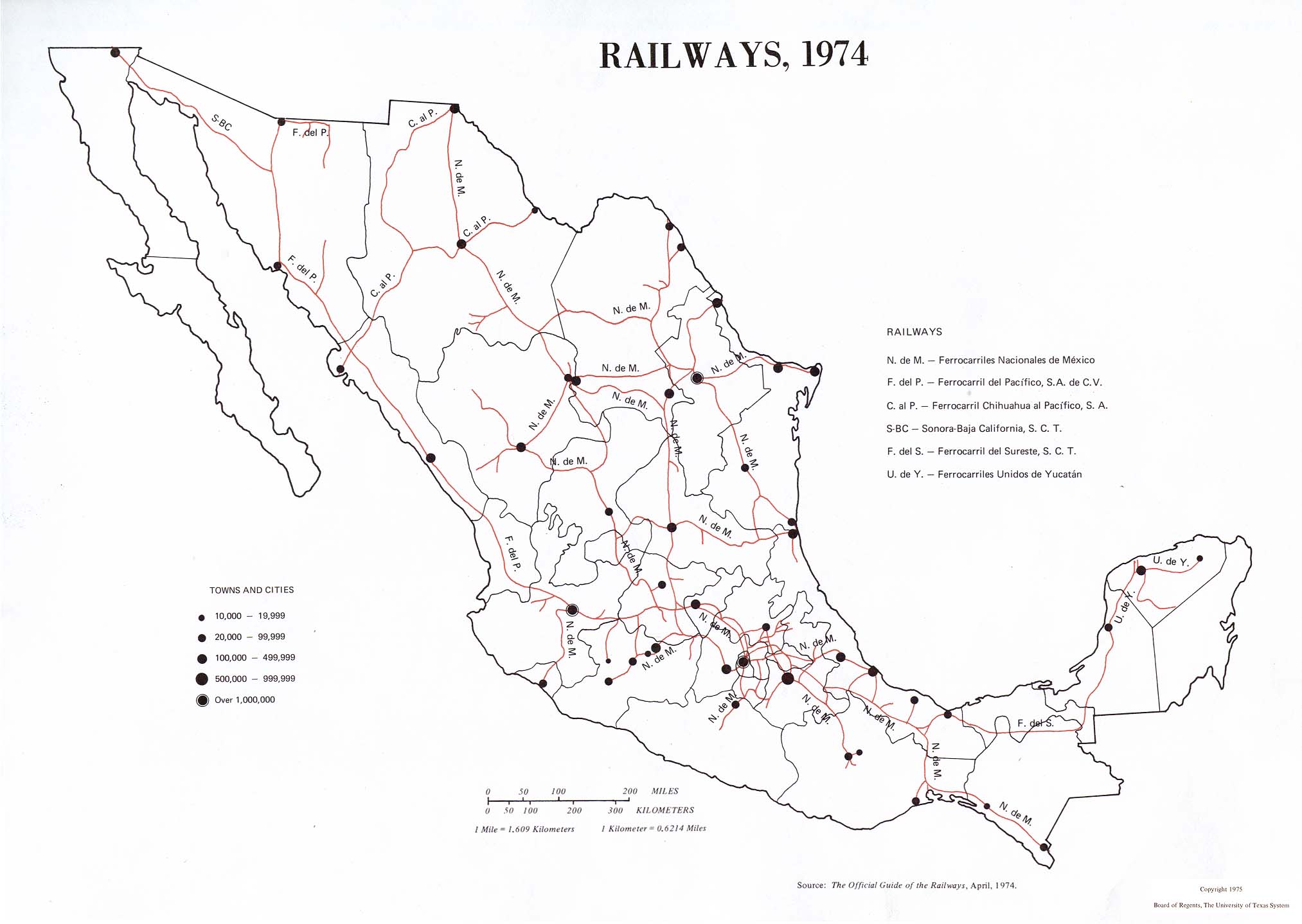
Figure 4.2 This map shows the many railways across Mexico. Railways are important because if I'm unable to drive from one city of choice, I have the option to take a train instead.

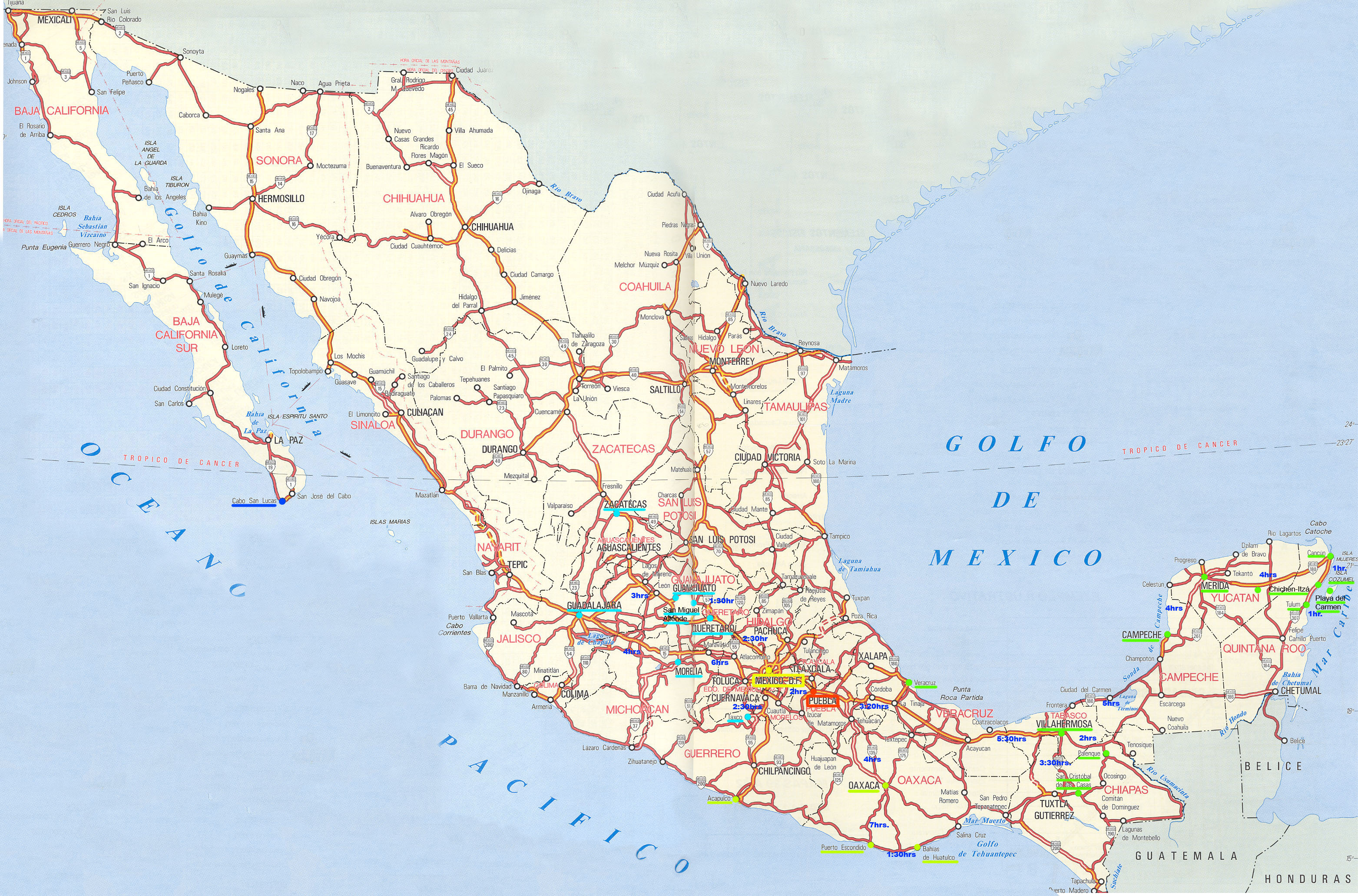
Figure 4.3 This map details the various roads throughout Mexico. This is a more detailed version of what the highway map is; the map allows me to see which cities are easily accesible through vehicle and which are not.
City Maps
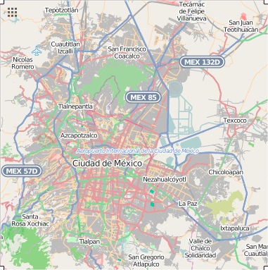
Figure 5.1 This is a detailed map of Mexico City. It shows me the different urban areas that surround the major portion of the city and how densly packed the city actually is.
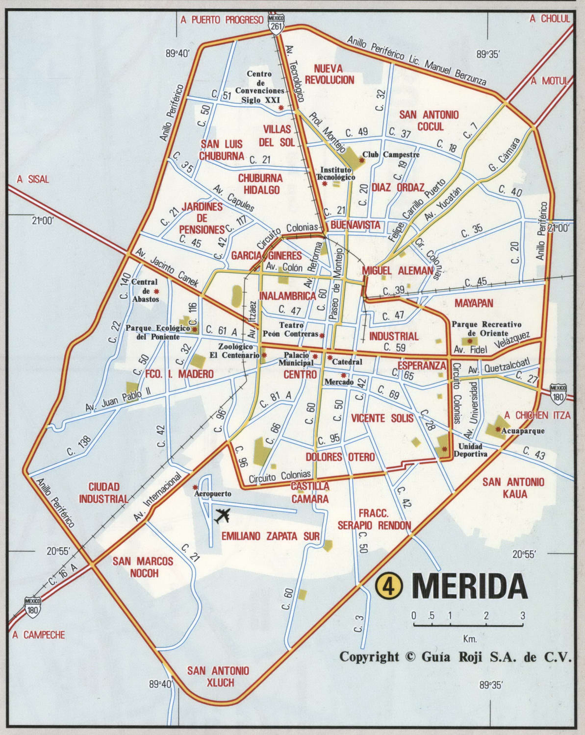
Figure 5.2 This is a detailed map of Merida. Knowing Merida's layout is important to successfully plan a trip.
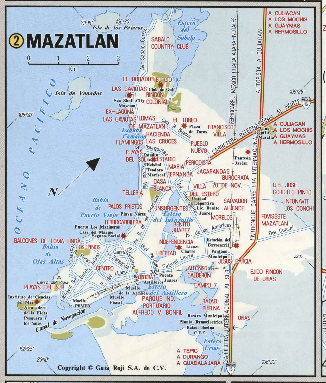
Figure 5.3 This is a detailed map of Mazatlan. The layout is unique compared to the other two cities above because of it's location on the coast.
Urban Transportation
![]()
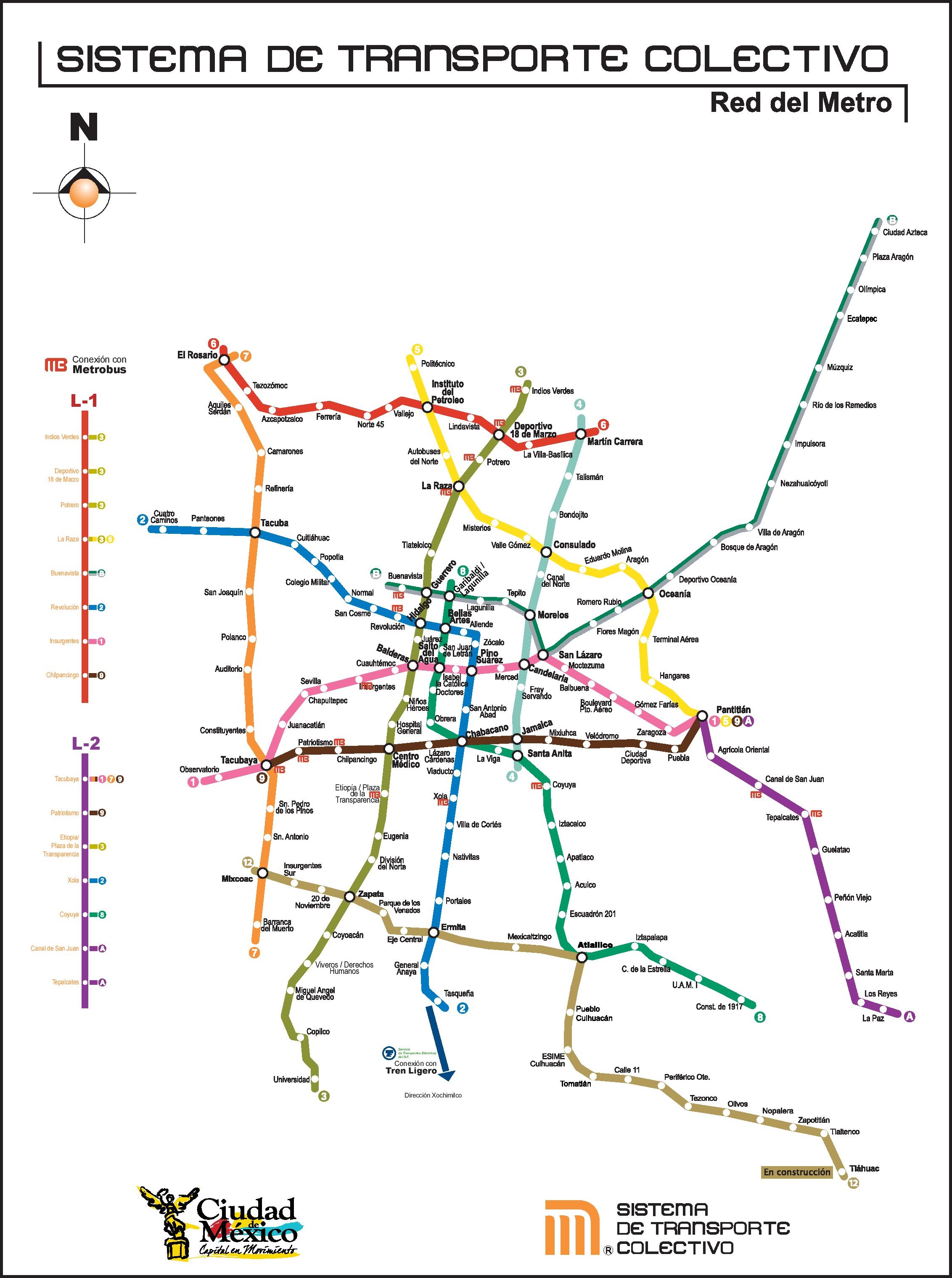
Figure 6.1 This map details the different Metrobus paths. This is important because it shows me which metrobus can be taken to get to my destination that day.
![]()
Figure 6.2 This map details the different transport routes within Merida city center. This map is also useful because it shows important places like hospitals.
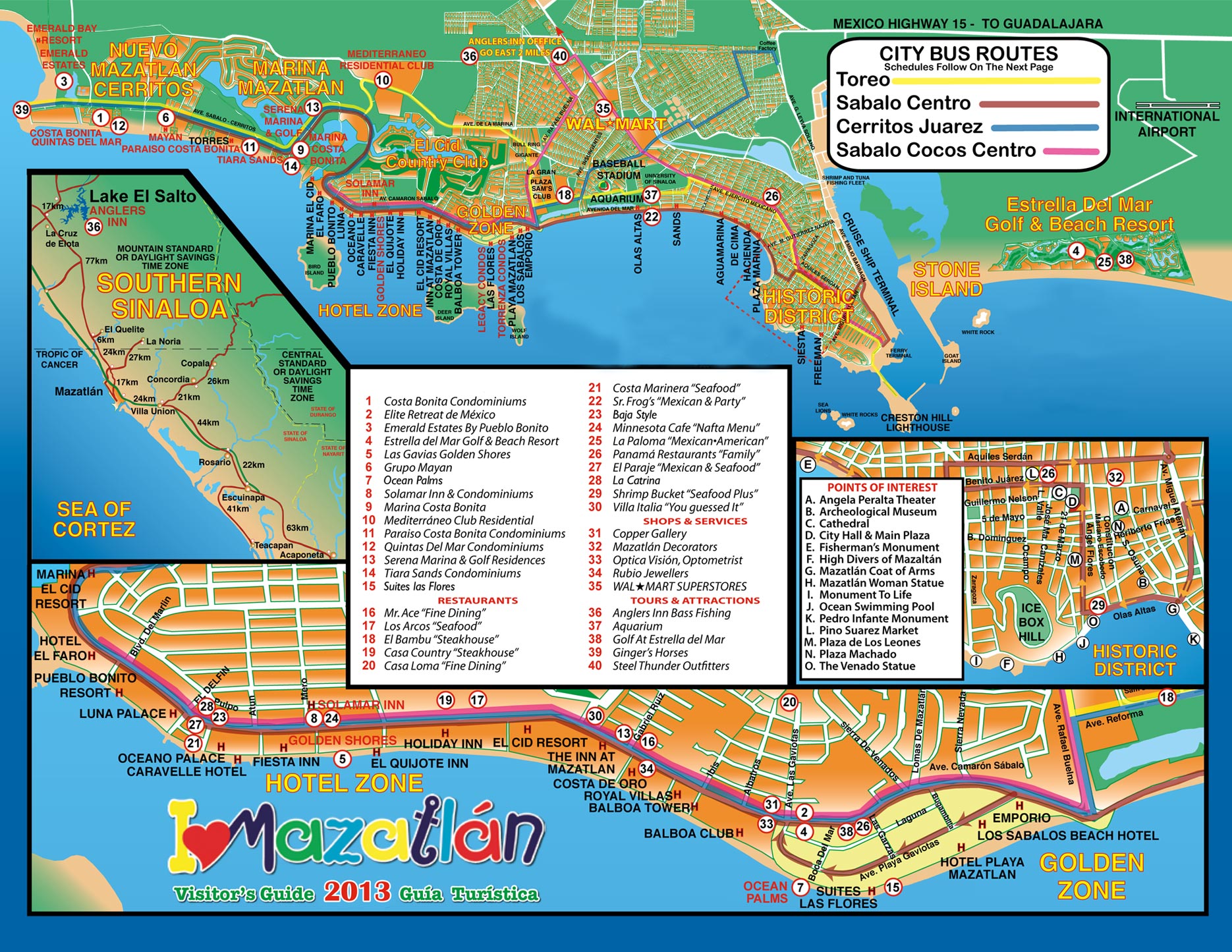
Figure 6.3 This map details the four city bus routes within Mazatlan. Knowing a buses route is important when planning a trip.
Tourist Sites
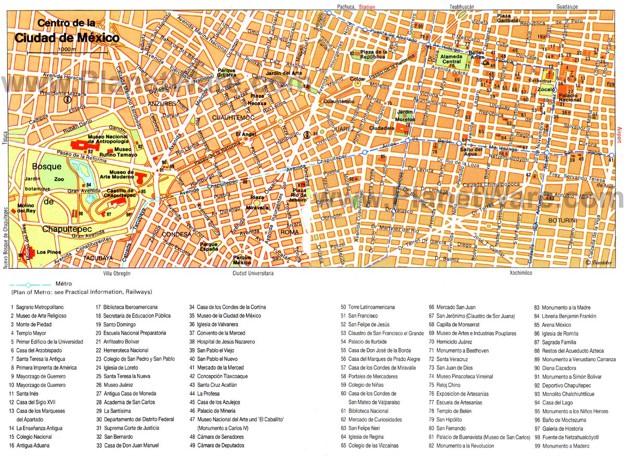
Figure 7.1 This tourist map shows 90 different tourist locations in Mexico City. This map gives me a plethora of options to chose from to visit. The link when clicked takes you to planetware.com, which shows you top places to visit; the map I have above is at the bottom of the page and can be enlarged for easier viewing.
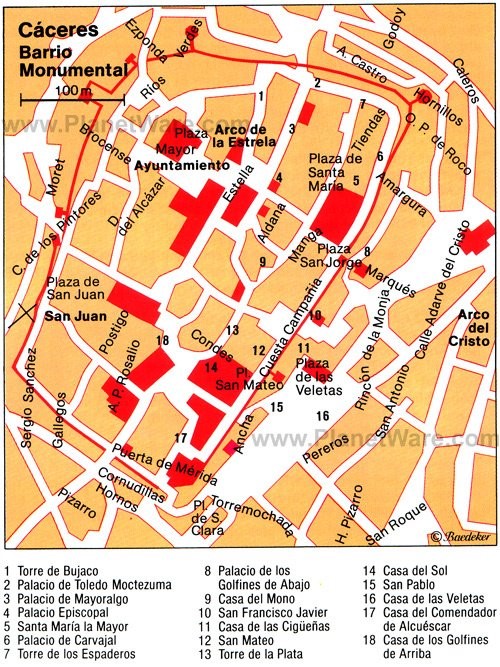
Figure 7.2 This tourist map shows 18 different tourist locations in Merida. The link when clicked takes you to planetware.com, which shows you a list of places you can visit; the map above is located at the bottom of the page and can be clearly englarged for easier viewing.
Figure 7.3 This tourist map shows amenities in Mazatlan. This map shows places available to stay along the cost, clubs, areas to swim, go snorkeling, shopping, eat, etc.
Submitted by Katie Holderfield on 3/5/2020