- Sumidero Canyon
- Cenotes of the Yucatan Peninsula
- Copper Canyon
- Hierve el Agua
- Mexico City Panorama
- Mazatlan Panorama
- Merida Panorama
- Tulum Panorama
- Chichen Itza
- Cathedral Metropolitana
- Teotihuacan
- Monumento a la Revolucion
- Agave Farmer
- Dia de los Muertos Celebration
- Frida Kahlo
- Tzeltal Women
- Snorkeling
- Volcan Paricutin
- Pico de Orizaba
- Chiles en Nogada
Landscapes
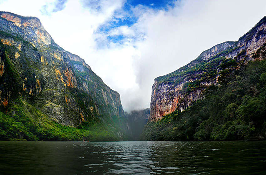
Figure 1.1 Located in the Mexican state of Chiapas, this canyons formation started approximately around the same time as the United States' Grand Canyon in Arizona around 35 million years ago. The canyon formed from the erosion of Grijalva River, which continues to flow through the canyon. The canyon walls are at high as 1,000m with some being straight 90-degree verticals and stretching a distance of 13km. In this canyon you can find 30 rapids, five waterfalls, three beaches, two freshwaters springs, and a cofferdam. You will also find Cueva de Colores; this name comes from the filtration of magnesium, potassium and other minerals that give the walls its colors.
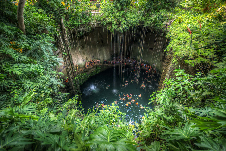
Figure 1.2 Located mostly in the Yucatan Peninsula of Mexico, these formations were created due to the collapse of limestone bedrock that exposed groundwater below. The cenotes of this region were important to the local Mayans that used them for sacrificial offerings.
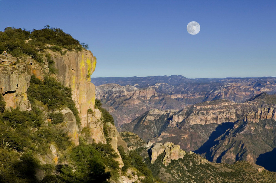
Figure 1.3 Located in the Mexican state of Chihuahua and Sierra Madre Occidental was formed around 30 to 40 million years ago. The series of canyons were formed by six rivers that drain the western side of the Sierra Tarahumara. This canyon got its name from the copper/green coloration of its walls. Unique to the canyon is the still current population of Tarahumaras that have lived in this area for centuries.
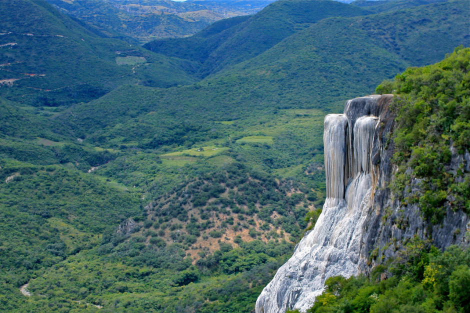
Figure 1.4 Located in the Mexican state of Oaxaca, is a set of unique rock formations that resemble the cascades of a waterfall. These formations were created from the high concentration of calcium carbonate and other minerals that come from nearby freshwater springs.
Cities
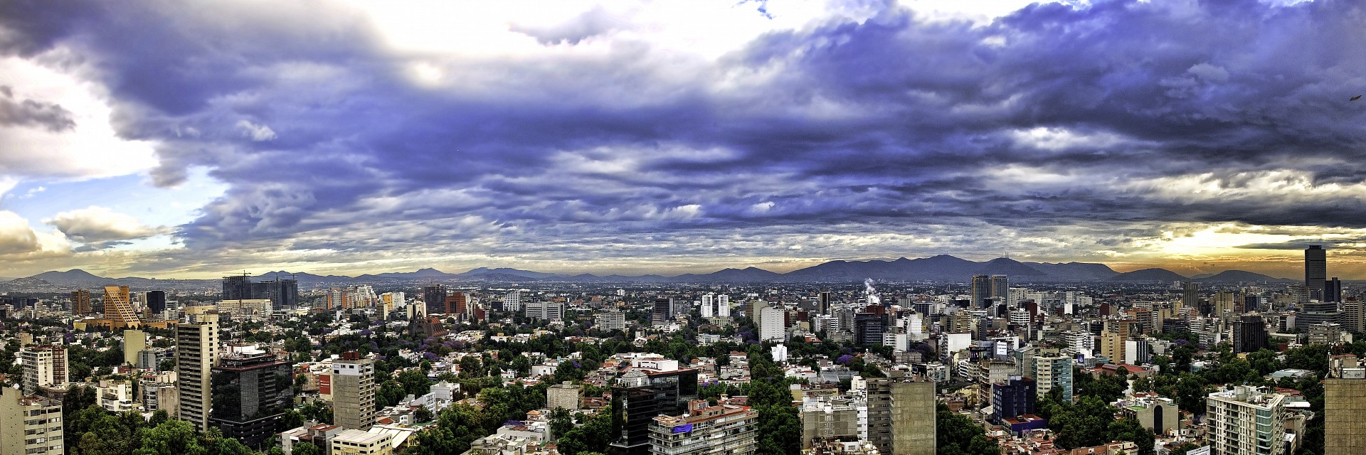
Figure 2.1 This panoramic aerial shot of Mexico City gives us a view of the sprawling area this city of 21.7 million people inhabits, which makes it the most inhabited city in the Western Hemisphere. Stories tell that the Mexicas (Aztecs) built Tenochtitlan in Lake Texcoco after one of their prophecies came true (Eagle eating a snake while perched on a cactus on an island in the lake). Hernan Cortes in 1520 conquered Tenochtitlan and built Mexico City on the ruins of this Aztec city.
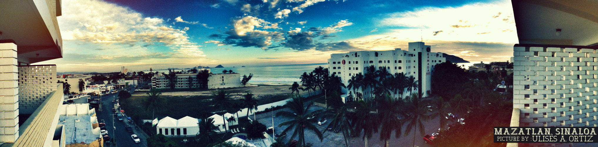
Figure 2.2 This panoramic shot appears to have been taken from a building facing towards the ocean and city below. Mazatlan was once inhabited by the Totorames that lived by hunting, fishing, gathering, and agriculture; Mazatlan means 'place of deer' in Nahuatl. It was in 1531 that Spaniard Nuno de Guzman founded a settlement before becoming a colony in the 1820s.
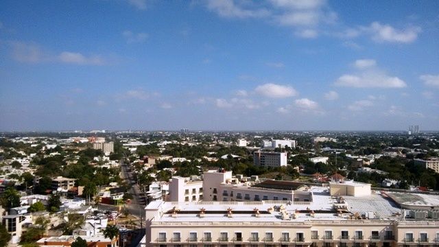
Figure 2.3 This panoramic aerial shot of Merida gives us a view of the city and its expanse across the Yucatan Peninsula. Merida has been a city in Mexico for centuries, long before the arrival of the Spaniards and was occupied by the Mayans. In 1542, conquerors from Spain came and established their city, and built convents to replace the once vibrant Mayan culture. By the 16th century, Mayan culture and its people were destroyed.
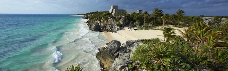
Figure 2.4 This panoramic shot gives us a glimpse into the beautiful atmosphere of Tulum with historical buildings situated off its coast. Tulum, which is located on the eastern coast of the Yucatan peninsula, was inhabited by the Maya and Toltecs. This ancient city was a central hub for trade in goods like cotton, food, copper, axes, and cacao beans. Because Tulum is protected by the jungles in Quintana Roo, this city managed to survive the Mayan collapse and mostly left untouched by the Spaniards. The Temple of the Winds in located in Tulum which was meant to honor the wind god that helped guide sailors through the reefs.
Landmarks
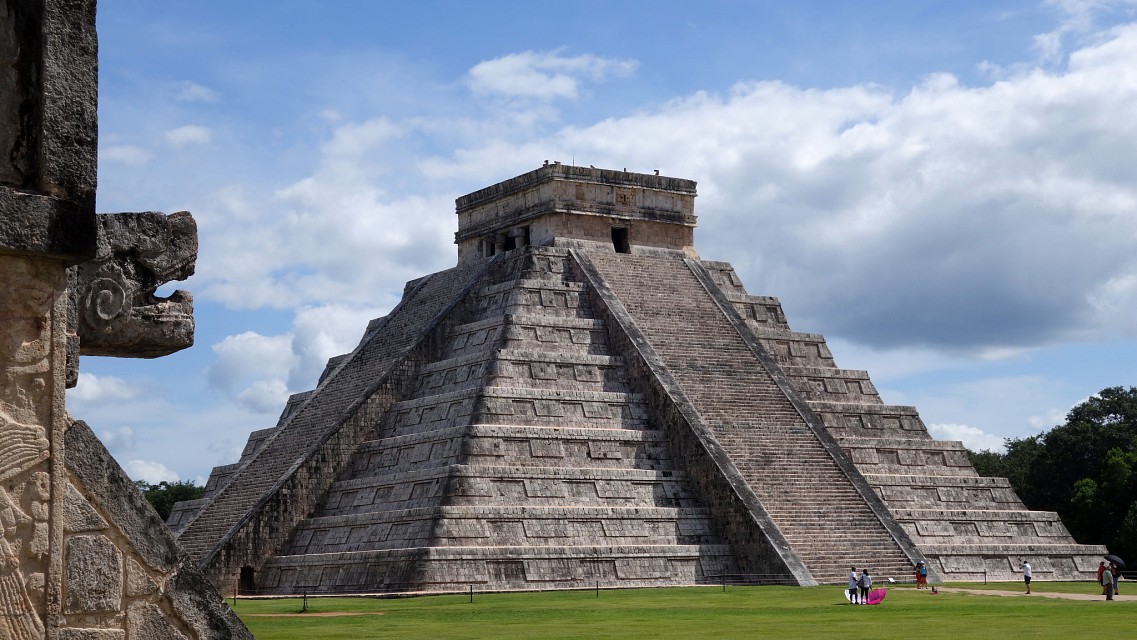
Figure 3.1 Estimates state that Chichen Itza is over 1,500 years old and spanned over several centuries of occupation by the Maya. Kukulkan Pyramid, which is in the photograph here, is considered one of the seven wonders of the world standing at 24 meters in height with an upper platform. Twice a year during the spring and fall equinoxes, you can watch the descent of Kukulkan (Quetzalcoatl), their serpent god.
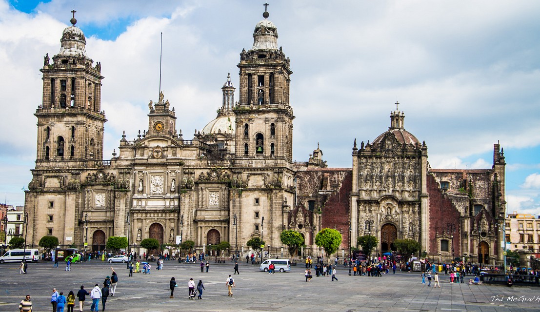
Figure 3.2 The Metropolitan Cathedral of Mexico City is considered to be one of the largest of its kind in the Western Hemisphere. Built over the course of 250 years (1573-1813), the architectural design of this cathedral was influenced by several eras of history: Spanish Baroque, Renaissance, and Neoclassical styles. The Metropolitan Cathedral has two neoclassical towers that hold 18 bells.
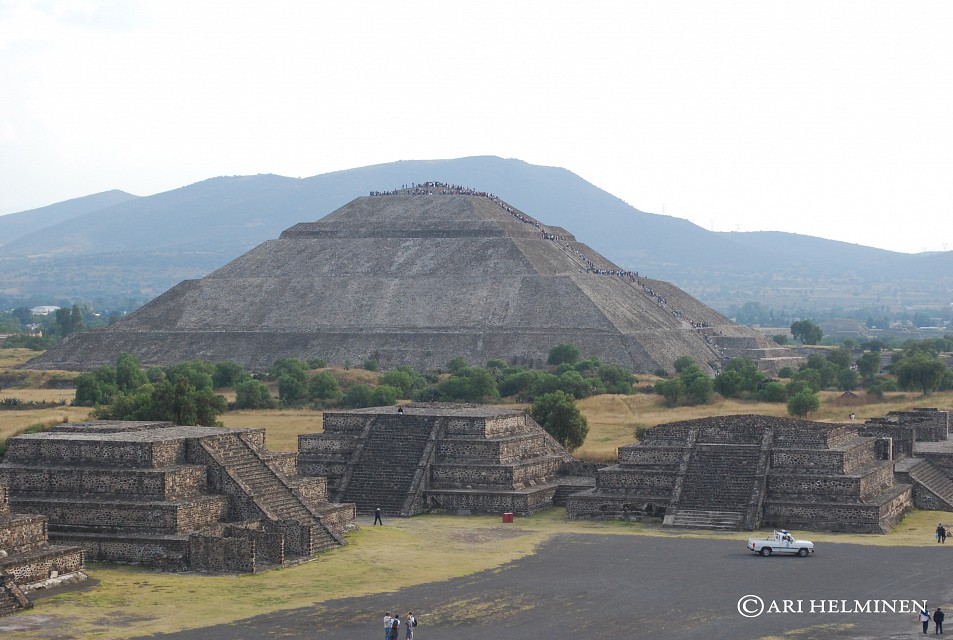
Figure 3.3 Approximately 40km from modern day Mexico City, Teotihuacan is architecturally significant because of the city's size, pyramids, and complex compounds and artwork. It's believed that Teotihuacan was the largest Pre-Columbian city in the Americas with a population of 125,000 people and was possibly a multi-ethic state. Teotihuacan covers 8 square miles of land. In this image you can see the Pyramid of the Sun; little is known about the importance of this pyramid or what its purpose was for as over the centuries looting and natural decay have removed much. Some hypothesis that it venerated a deity, but little evidence has been found to support this.
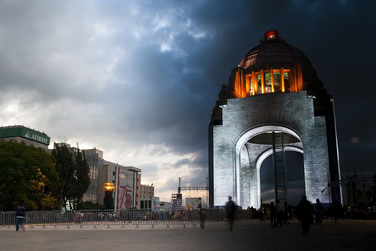
Figure 3.4 This monument commemorates the Mexican liberation from the Spaniards and was created by architect Carlos Obregon Santacilia and took 28 years to build because of the ongoing Mexican Revolution (1910-1938). Standing at 67m high, it is considered the tallest triumphal arch in the world. This monument is also the burial place of several Mexican heroes of the revolution: Francisco I. Madero, Francisco "Pancho" Villa, Venustiano Carranza, Plutarco Elias Calles, and Lazaro Cardenas.
Images of People
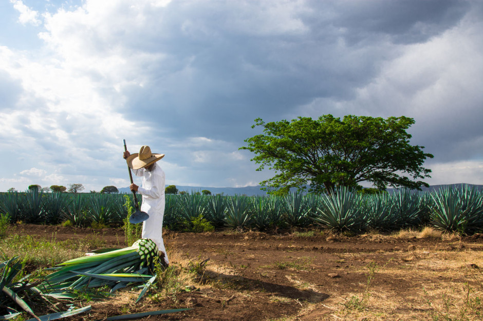
Figure 4.1 In this image we see a man working in a vast agave field in Jalisco where the majority of this plant grows. Agave is cultivated for the use in creating Tequila and a main ingredient in foods; it is also called aguamiel, or "honey water" in Mexico. Interesting facts about agave include that it has a lower glycemic index than refined sugar making it an ideal substitute to most other sugar products.
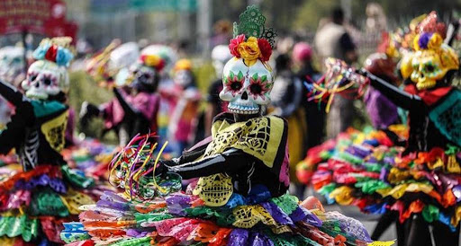
Figure 4.2 Several women are dressed in colorful, vibrant outfits and each adorn an intricately designed skull mask; they dance in the streets of Mexico City during the celebration of Dia de los Muertos. The significance of this celebration is deeply engrained in Mexican culture. This mutli-day holiday is a gathering of people to celebrate and remember their deceased relatives and aid their journeys into the spiritual realm. This holiday can be traced back to the Aztec festival dedicated to the goddess Mictecacihuatl whom ruled the underworld of Aztec mythology.
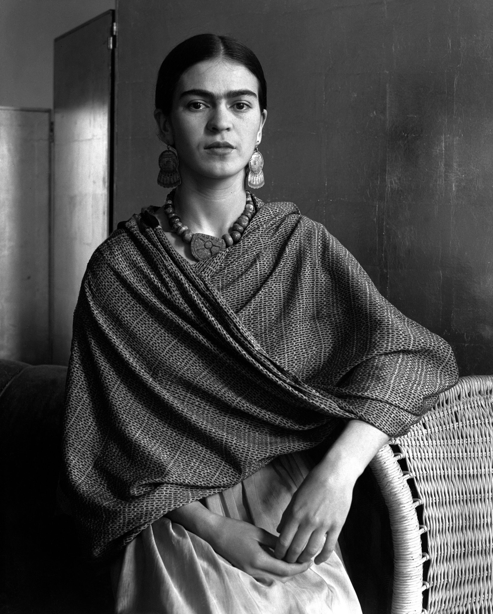
Figure 4.3 This elegant black and white portrait is of the famous Mexican artist, Frida Kahlo. Frida is considered to be one of the most famous figures in Mexican culture and history for her self-portraits and paintings of nature and artifacts in Mexico; much of her work is also tied to identity, postcolonialism, gender, class, and race in Mexican society. She was also a part of post-revolutionary movement, Mexicayotl. Her childhood home can now be visited in Coyoacan where you can view her artwork.
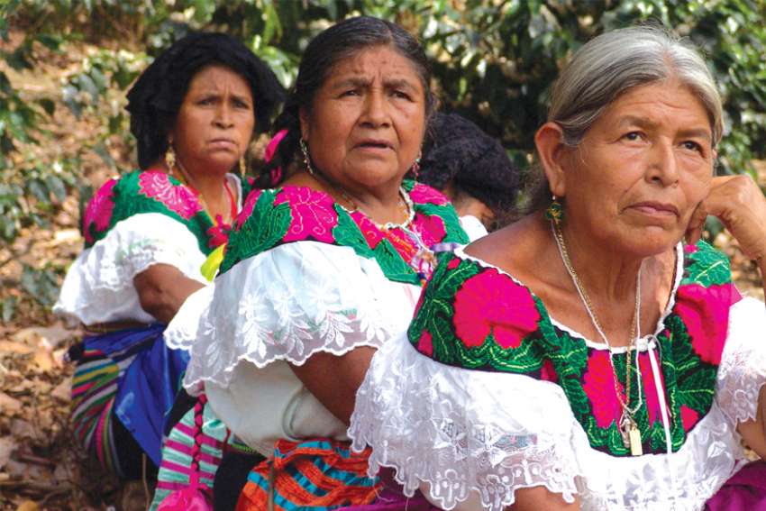
Figure 4.4 This photo shows several Tzeltal women in traditional dress called huipils, participating in a community assembly in Chiapas; this meeting was taking place to help bring awareness to poverty that is rampant among the indigenous peoples and the Mexican governments history of ignoring their plights. The Tzeltal people are indigenous to the Chiapas of Mexico and descendants of the Maya.
Images from the Book
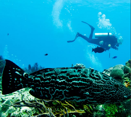
Figure 5.1 In this image we can see a man snorkeling among several fish thriving in a coral reef off the coast of Isla Cozumel (this location is known for its excellent environment for diving). Snorkeling is a common activity you will find among the coastal cities of Mexico, especially by the resorts.
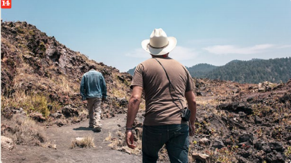
Figure 5.2 This cinder cone volcano is located in the Mexican state Michoacan. Story goes that a farmer by the name of Dionisio Pulido in 1943 discovered its emergence from the cornfield. The volcano only erupted for approximately nine years growing to a 424m high and considered to be one of the youngest volcanoes on Earth.
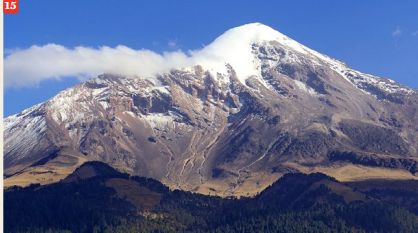
Figure 5.3 The summit of this volcanic mountain sits at 5636m and is the third tallest stratovolcano in North America. Located on the Trans-Mexican Volcanic belt between the states of Veracruz and Puebla; this volcano is currently dormant with its last eruption occurring in the 19th century. Pico de Orizaba is considered to have the second most prominent volcanic peak behind Mount Kilimanjaro in Africa.

Figure 5.4 This delectable Mexican traditional dish is a stuffed poblano chile; picadillo is the mixture put inside the poblano which contains meat, aromatics (pomegranate seeds), fruits (apples, pears, and peaches), and spices. Topped on this dish is a walnut-based cream sauce and pomegranate seeds. You will find most Mexicans enjoying this dish between August and September when pomegranates appear in regional markets and independence festivities.
Submitted by Katie Holderfield on 4/2/2020